0
River Levels
River Levels
RIVER LEVELS


Don’t walk through flood waters. It only takes 6 inches of moving water to knock you off your feet. If you are trapped by moving water, move to the highest possible point and call 911 if possible. Do NOT drive into flooded roadways or around a barricade; Turn Around, Don’t Drown! Water may be deeper than it appears and can hide hazards such as sharp objects, washed out road surfaces, electrical wires, chemicals, etc. A vehicle caught in swiftly moving water can be swept away in seconds 12 inches of water can float a car or small SUV, 18 inches of water can carry away large vehicles.
- 18.5’…High water mark of the 1913 and 2007 floods.
- 17.5’…Flooding can be expected from Westerfield Drive to County Road 236 along the Blanchard River. Flooding can also be expected along Eagle and Lye Creeks between State Route 15 and the Blanchard River. About three quarters of the city inundated.
- 17’…FEMA 0.2 percent flood level. Hundreds of properties along the Blanchard River and tributaries flooded.
- 16’…FEMA 1 percent flood level. Flood waters extend from West Main Cross Street near Interstate 75 ramp. Numerous properties between the river and West and East Cross Street impacted. Water extends further north of the river to Frazier Street, Broad Avenue, and Center Street. Blanchard River flood waters will combine with backwater from the Lye and Eagle Creeks.
- 15.5’…Several businesses impacted downtown, with many roads near the river closed. County Road 236 to State Route 568 inundated. The following streets are likely to be flooded, Main Cross Street from Western to Township Road 180, Broad Street, streets along Eagle Creek from Central to Rockside and streets along Lye Creek from Wedgewood to Strong Avenue.
- 15’…West Main Cross Street flooded and detours likely around downtown. East Main Cross Street impassable. Flood waters extending further north of the river on Blanchard Street to Center Street. Defiance Avenue through County Road 223 with water impacting the property of Wal Mart.
- 14.5’…Major flooding blocking Martin Luther King Parkway and Blanchard Avenue. Several other low lying roads flooded along the river. Travel in and out of the city becomes difficult.
- 14’…Flood waters impacting Martin Luther King Junior Parkway from Clinton Court to Blanchard Street. Backwater issues from the Lye and Eagle Creeks likely if those tributaries are also running high.
- 13.5’…Water impacts River Street and Apple Alley on the west side of Findlay, Blanchard Street between Sandusky and Main Cross, and several streets south of Clinton Court near Riverside Park.
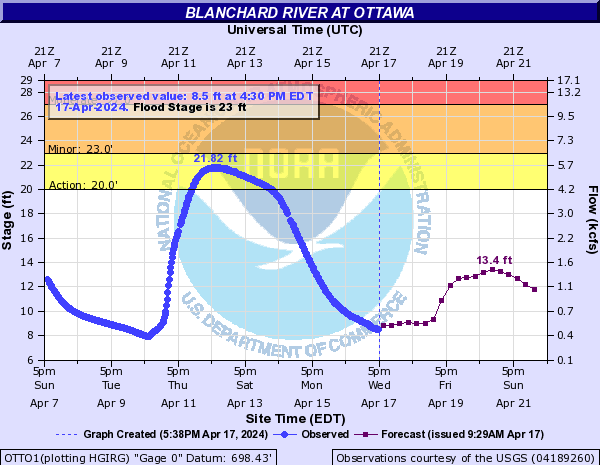
- 29’… Widespread major flooding occurs throughout downtown Ottawa.
- 27’…Flooding worsens on the south side of Ottawa, with water on several roads. Flooding also begins in other areas of Ottawa.
- 26.6…Flood water begins to hit the bottom of the bridge at the gage site.
- 25…Flooding begins along south Walnut and west Second Streets on the south side of Ottawa.
- 23…Lowland flooding occurs mainly in south Ottawa. Flood water also gets into low farmlands.


